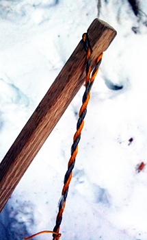
Flemish style string, bow tip
Since making a bow a few weeks ago, I’ve been working on learning the other skills needed to complete a traditional archery set. First was the string. I had been using regular nylon string from the hardware store, and it’s amazing how much better a real bowstring performs at transferring energy to the arrow. The bowstring is composed of 14 strands of Daycron / B-50 fiber twisted into two bundles which are also twisted together, called a Flemish string. The twist of the full string on the bow is what holds the twistings of each loop together without any knots, glue or other fasteners. I haven’t put the serving on yet (this is a thin string wrapped around the bowstring where the arrow is nocked) because I’m not sure if the string will need to be shortened by twisting the string further, but it shoots great without it.
The photo on the right shows the tip of the bow. The notches were filed into the wood with a chainsaw file and do a surprisingly good job at holding the bowstring. The red oak is about ½" square at the tips and gets progressively thicker and wider toward the center of the bow, which is almost six feet long.
I’ve been borrowing some arrows from a friend at work, but have successfully made a few arrows of my own. I used 11/32" cedar shafting, dipped in spar varnish thinned with turpentine. After the finishing, building an arrow is a fairly straightforward process of tapering the ends for the nock and tip, and affixing the feathers. The nock and feathers are glued with what smells like cyanoacrylate glue and the points are glued on with hot melt glue. Hide glue would be more traditional, but for my early efforts I’ll stick with something simpler.
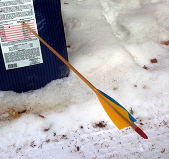
Cedar shafted arrow
The target shown in the photo is a series of dog food bags, filled with newspapers and taped together (two things we have a lot of are dog food bags and newspaper!). Each bag probably has between eight and ten newspapers in it, and there are at least eight bags taped together. It seems to work well with the steel field points I attached to this arrow. My previous target was a cardboard box filled with packing peanuts, but that was only good enough to slow down the arrows. Even with rubber blunt tips (“bunny busters”), they’d go right through the box and skitter down the driveway.
I still need to experiment with the best shafting, arrow configuration and point weight for my bow. Because the arrow rests to the left of the centerline of the bow, this means that the arrow is actually bent against the bow as it’s released, and if the shafting is too stiff or not stiff enough, the arrow won’t fly true. I haven’t actually noticed this effect, so either I choose the correct “arrow spine” (50-55), or I just haven’t shot enough or from far enough away to see it.
At this point, I can hit the bag about 90% of the time from 25 feet away (beware home invaders!), and can hit an area the size of a DVD about 50% of the time from that distance. But I haven’t shot nearly enough arrows in succession to have a feel for it yet. I have taken my bow out on the trails with rubber-tipped arrows (OK, arrow), but if I came upon a snowshoe hare within my limited range, I’d have to get very lucky to hit it. Even with a .22 rifle, snowshoe hares can be a challenging target. As my friend Igor says, “If it was easy, it’d be Fred Meyer.”
I still need an arm guard, finger tabs and a quiver, but haven’t really settled on what varieties of these accessories to use.
Here’s the bow and an arrow in my target:
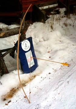
Bow and arrow
We closed on a new piece of property last week and I’ve been exploring it on the ground and with Google Maps. There’s already a well-established non-motorized trail along two side of it, and based on the satellite imagery, it looks like there’s a partial trail approximately through the middle. I found it on the ground yesterday, and today I made an attempt at figuring out a way to connect the two trails. There’s still a foot of snow on the ground, so it’s wasn’t easy going, but I did snowshoe my way around. I’d hoped my snowshoe tracks would have hardened enough to walk it in boots this evening, but the snow had turned to sugar instead. Hopefully it’ll harden tonight when the temperature drops.
I’ve been on and off carrying my .22 rifle over the past couple months looking for grouse and snowshoe hare (hares?). I haven’t seen any grouse since I started carrying, but both last week and today I’ve seen hares. So far I’ve seen three on our property, and each time I saw them, I wasn’t carrying my rifle or my bow. The hare I saw this morning may have been laughing at me. Hares have a very clever strategy for eluding predators: when startled they run a short distance through the brush, freeze for ten to twenty seconds, then run again. For predators that are focused on movement, I think the momentary pause allows the hares to disappear due to their excellent camouflage. For a human hunter it’s a challenge because just as you get the animal in your sights, it bolts. And since you’re looking through your sights or scope, it’s much harder to pick them up after they’ve left the view. Anyway, the hare today was 20–30 feet away, in plain sight, and showed no sign that it considered me a threat. It kept right on eating alder shoots, preening, and at one point even got up on it’s hind legs and looked around. It would have been an easy target for my bow.
Had I been carrying it.
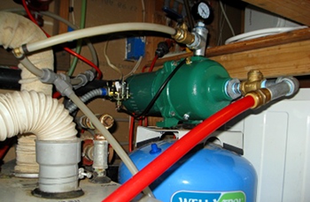
Spent much of the day today getting parts and replacing our water pump. The old one wasn’t drawing water out of the tank very well, didn’t show pressure on the gauge, and couldn’t be primed without taking it off of the pressure tank. Earlier in the week we had a brief freeze-up of our supply line and I decided it was the last time I was going to drag the old pump off the pressure tank just so I could prime it.
The new pump is a Myers pump, Made in the U.S.A., and seems to be a little quieter than the old one. While I was doing it, I replaced a few more of the plastic compression fittings in the mechanical room with crimp-style fittings. The plastic ones are no longer sold because they eventually leak.
One remaining issue is getting the pressure tank and the pressure switch working well together. When I first hooked it up, I lowered the pressure tank to 18 psi (2 pounds lower than the low setting the switch is supposed to default to), and the pump starting rapidly switching itself on and off again. I tried lowering the pressure in the pressure tank until there was nothing left in it, and then started looking at the new gauge. Turns out the new switch was set to something like 15–30 instead of 20–40. After I filled the pressure tank back to 18 psi and adjusted the pressure switch to 24–35, everything works without the on-off-on-off problems. I’d like it to be closer to 20–40, but that will take some fine tuning of the pressure switch.
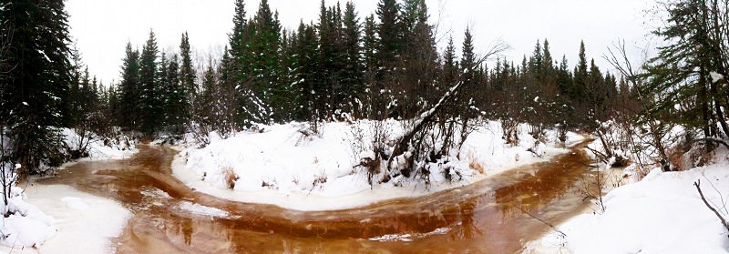
Overflow near DNR pond
I took Friday off from work again this week and brewed Overflow Old Ale. I drained the chilled wort directly onto the yeast cake from last week’s brewing effort, so I should get a nice fast start from the yeast. The recipe was supposed to be a high alcohol (7%) lightly hopped ale, but instead of an expected 70% efficiency at extracting sugars from the grain, I wound up at 57%. That’s the lowest efficiency I’ve ever gotten. I wouldn’t mind so much if they were consistent, but they’re all over the map, and I don’t know what is causing the variation. Same base grains, same procedure and equipment, same thermometer, etc. It’s a mystery.
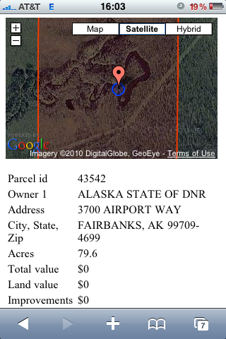
Location of photo
The good news is that nothing went wrong, and beer is beer regardless of whether it turned into the batch you were planning to brew. I’m sure I’ll enjoy drinking it at least as much as I did brewing it.
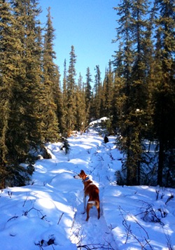
The batch is named for the overflow that’s currently moving across the top of the frozen Creek. I took advantage of it and used it in my counterflow chiller to bring the boiling wort down to pitching temperatures in 10–15 minutes. The water is at least a foot deep, and I don’t think it’s been warm enough for it to be a natural phenomenon. Last year’s overflow event was rumored to be a large discharge from the mine several miles upstream from our house, and this event looks similar. Despite providing chiller water, it’s a drag because it’ll take at least a week for it to freeze solid again and until it snows it’ll be treacherous to walk on. I had hoped the overflow would have flooded the DNR pond again, as it was really fun ice skating on it last year, but the floodwaters aren’t high enough to cross onto the pond. The photo at the top is taken where the Creek passes the pond.
The photo on the right shows the Google Maps image of the location I took the photo using the iPhone web app I wrote. This morning I added some code to draw a blueish buffer around the GPS location that’s sized using the reported GPS accuracy. It also scales the map so that the entire property fits on the screen (I zoomed in before taking the photo on the right). I think the app is pretty much finished, except I want to add Fish and Game Management Units to it. Unfortunately, they don’t have GIS files for the smaller Management Areas, so it won’t be as useful as it could be. You can see I’ve drained my battery playing with it!
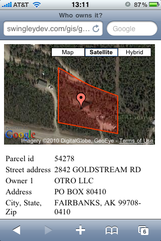
Updated web app
http://swingleydev.com/gis/loc.html
(for GPS enabled phones within the Fairbanks North Star Borough)
Now that my two year web hosting contract with BlueHost is coming up, I’ve decided to migrate over to Linode. It’s about twice as expensive, but you get your own Xen virtual machine to do with as you want. With BlueHost I wound up needing to compile a whole bunch of software packages (gnuplot, remind, spatialite, a variety of Python modules, etc.) just to get my site to work. And I couldn’t upgrade PostgreSQL, which left me unable to use PostGIS. With my Linode, I put the latest Ubuntu on it, and was able to install all the software I need.
As mentioned, PostGIS is one of the benefits of this. Instead of loading the Fairbanks North Star Borough tax parcel database into spatialite and using a CGI program to extract data, I’m able to query the same data in PostGIS directly from PHP. That means I can do all sorts of cool stuff with the data I’m extracting.
Here, I am using the Google Maps API to draw the property polygon and put a marker at the location from the iPhone’s GPS. You can see the result on the right, taken while eating lunch at the office. If you’ve got a GPS-enabled smart device and you’re in the Fairbanks North Star Borough, the link is http://swingleydev.com/gis/loc.html.
The code that drives the map is at the bottom of this post. The complicated query in the middle of it gets the outermost ring from the polygon, and dumps each vertex as a separate row. This section is in the middle of the Google Maps JavaScript that builds the overlay polygon. Note that this doesn’t handle the few properties in the database that have multiple polygons in their geometry, and it ignores the holes that might be present (if a small chunk out of the middle of a property was sold, for example). I expect these cases are pretty infrequent.
One enhancement would be to include a circular buffer around the point marker so you could get a sense of where the GPS accuracy places you on the map. This is complicated with Google because of the custom projection they’re using. I think it’s called “Google Mercator,” but spatialreference.org lists several projections that look like they might be compatible. I’ll have to give those projections a try to see if I can make a projected circular buffer that looks like a circle. It would also be nice to set the map extent to match the extent of the parcel you’re inside. I don’t know if that’s part of the Google Maps API or not.
Here’s the code:
<script type="text/javascript">
function initialize() {
  if (GBrowserIsCompatible()) {
      var map = new GMap2(document.getElementById("map_canvas"));
      var mapControl = new GMapTypeControl();
      map.addControl(mapControl);
      map.setCenter(new GLatLng(<?php echo $lat; ?>, <?php echo $lon; ?>), 14);
      var polygon = new GPolygon([
        <?php
            $query = "
SELECT
    ST_X(ST_PointN(ST_ExteriorRing(ST_GeometryN(wkb_geometry, 1)),
        generate_series(1, ST_NPoints(ST_ExteriorRing(ST_GeometryN(wkb_geometry, 1))))))
        AS x,
    ST_Y(ST_PointN(ST_ExteriorRing(ST_GeometryN(wkb_geometry, 1)),
        generate_series(1, ST_NPoints(ST_ExteriorRing(ST_GeometryN(wkb_geometry, 1))))))
        AS y
FROM tax_parcels
WHERE ST_Intersects(wkb_geometry, ST_SetSRID(ST_MakePoint($lon, $lat), 4326));";
            $result = pg_query($query);
            $num_rows = pg_num_rows($result);
            for ($i = 0; $i < $num_rows - 1; $i++) {
                $row = pg_fetch_row($result);
                list($vlon, $vlat) = $row;
                echo "new GLatLng($vlat, $vlon),";
            }
            $row = pg_fetch_row($result);
            list($vlon, $vlat) = $row;
            echo "new GLatLng($vlat, $vlon)";
            pg_free_result($result);
        ?>
      ], "#f33f00", 2, 1, "#ff0000", 0.2);
    map.addOverlay(polygon);
    var point = new GLatLng(<?php echo $lat; ?>, <?php echo $lon; ?>);
    map.addOverlay(new GMarker(point));
  }
}
</script>
